Clusters - useful feature for those who has large number of objects and markers: Clusters split markers and objects into groups. According to map zoom level will reveal content inside of it
Street view - enable/disable street view. (Subscribed users only)
Live traffic - shows status of traffic on map (available only with Google Maps for subscribed users)
Fit objects on map - sets map zoom level to fit all objects
Ruler - measures distance between points
Measure area - measures area
Route controls- enable/disable loaded track route features
Route -enable/disable tracks route visibility
Snap - enable/disable snap routes on track visibility
Direction - enable/disable tracks direction arrows visibility
Data points - enable/disable data points on tracks visibility
Stops - enable/disable stops on route visibility
Events - enable/disable harsh events visibility
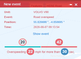
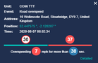
Overspeed - enable/disable road speed limit overspeed on track visibility
Hide - hide/close generated track
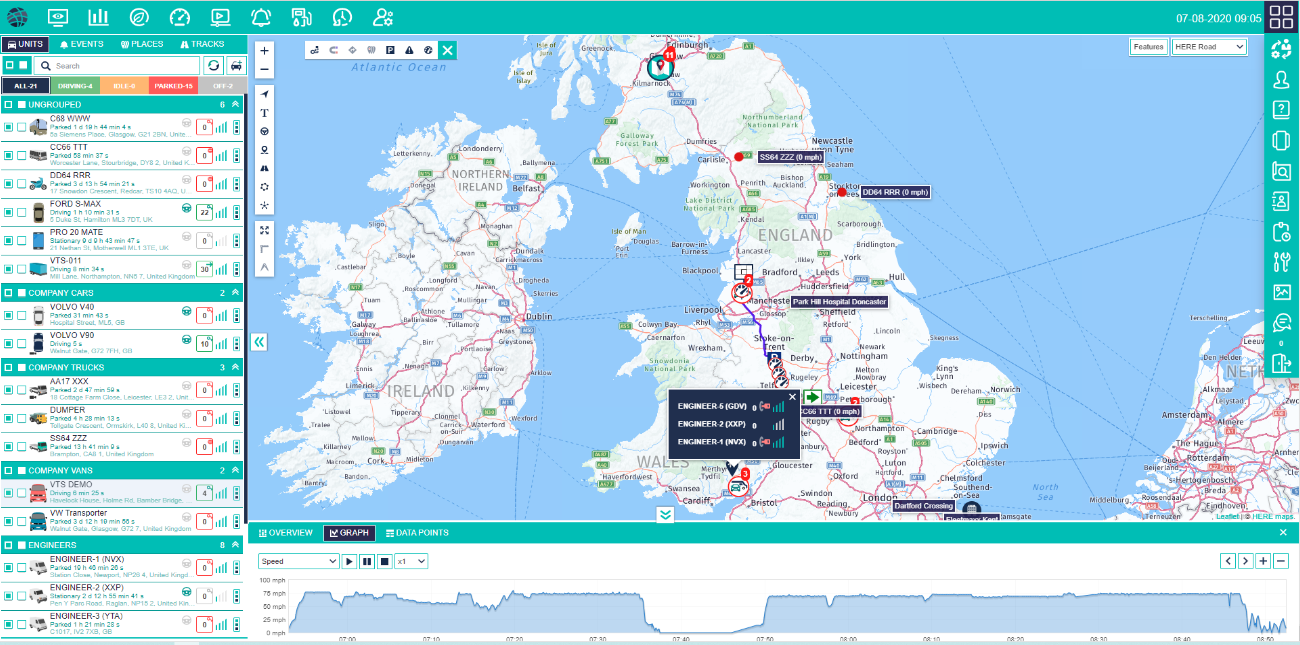
Live map allows to access most common tracking features and settings, monitor object location on map, status, speed, address, tracks, events, reports, summary, service, notifications and more.
Left side top panel
Right side top panel
Bottom panel
Left side panel
Tracks controller
Notification
Map layers, features
Tools
Zoom
Visibility Units Drivers POI’s Routes Groups Clusters
Unit summary
Over speed event
Grouped units list
Harsh event information
Track
Grouped places
Unit menu
Grouped units
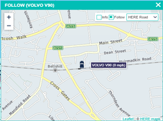
Individual follow window
Unit information detailed view on map
Top left panel - this panel provides access to: Reports, ECO drive, Dashboard, Vision, Events, Fuel account and Settings. See Top panels…
Right side Panel - this panel provides access to: user, user guide, mobile version login, address search and and Log out, if user has privileges access to: logbook, tasks, maintenance, gallery and Chat. See Top panels…
Left panel - this panel provides access to: Units list, Events, Places and Tracks. See Left Panels: Units…, Events…, Places…, Tracks….
Bottom panel - all important information about selected object: current location, status, sensors, services and other data. See Bottom panel…
Map controls
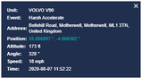
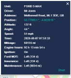
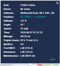
Unit details - information about selected object is shown in this popup: current location, speed, sensors, services and etc.
Hide/un-hide left side panel
Hide/un-hide botttom panel
Resize bottom panel holding white border
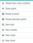
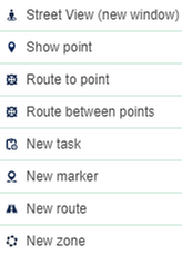
Right click on map menu
Street view and Live traffic available for Google map subscribers!
Street view
Map menu
Open new tab with Google map
Shows POI
Shows route to POI
Create -route between POI’s
Open Tasks window with selected POI
Creates new POI
Ctreates new route
Creates new geozone
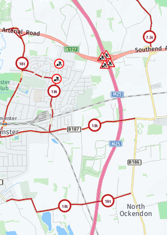
Map layers and features
only with Here maps
Enable POI visibility
Enable trucks restriction visibility
Enable road works visibility
All selected shows warning signs on live map to nearest units